There is an intriguing island that can be seen in the distance from the Tuas shore. 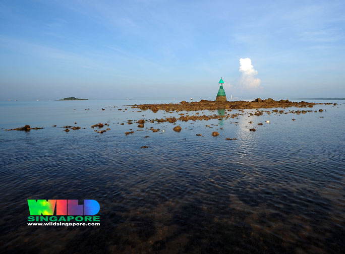
 This island is Pulau Merambong that lies on the Malaysian side of the border that cuts through the Straits of Johor. It's the yellow spot with a green surround on the navigation map above. While Merawang Beacon is the green bit sticking out of the straight-line coast of Tuas. Higher up is the Second Link.
There was recently an article in the New Straits Times about Pulau Merambong which shares a little about what can be found there.
Here's some extracts from Pulau Merambong: Fears of Singapore staking a claim
Satiman Jamin, New Straits Times 9 Jun 08
full article on wildsingapore news
For a small island, Pulau Merambong has three beaches - sandy, rocky and mangrove.
Although marine life is not as abundant as it used to be, the rare kilah or noble volute (Cymbiola nobilis) and some starfish can be found during low tide.
The kilah's sweet flesh and patterned shell are highly sought after.
It is said that seahorses and dugong used to thrive in the waters, but sightings of the creatures are rare nowadays.
A newly-painted lighthouse stands at the southeastern tip of the island. Malaysian and Johor flags perched on the tower are the only visible evidence of our country's sovereignty over the island.
Further inland, a Muslim graveyard dominates the small plains at a foothill.
Fisherman Mohd Khairul Anwar Abdul Rahman, 23, said decades ago, the folk of Gelang Patah would bury their dead on Merambong as the mainland's wild animals could dig up bodies from the graves.
The graveyard is unsafe for the barefooted as the flat, thorny seeds of the sepetir tree carpet the ground.
Sepetir (Sindora siamensis) is in the list of threatened species of the International Union of the Conservation of Nature in 2006.
On the hilltop, there are two more graves under a zinc-roof shed. The kettles and water containers in the shed suggest that people had stayed there before.
Behind the hilltop graves, more than five large holes are found in the wooded area, whose origins are linked to stories of people digging for treasures left by pirates.
Only the sandy and mangrove beaches are accessible from the hilltop.
The steep cliff with jagged rocks and mossy slippery boulders is a natural barrier to the rocky beach.
The rocky beach can be divided into three areas: the rocks and boulders underneath the cliff; the wide expanse of terraced ridges of jagged rocks; and an area of stones and pebbles carved by waves.
Snails, crabs and bivalves live in the cracks and in between rocks, only visible during low tides.
The sandy beach is made up of tiny granules of pulverised rocks, the result of waves pummelling the rocky beach next to it. Thus, the sand has the same reddish brown colour as the rocks.
A few metres from the lighthouse, at the edge of the sandy beach, rambong shrubs abound. It could have been the namesake of the island
 The unique terraced rocky beach of Pulau Merambong
Bernama 8 Jun 08;
full article on wildsingapore news
The Malaysian government should develop the island, he said, adding that it was strategically located at the centre of shipping route to the Port of Tanjung Pelepas, Tanjung Bin power generation plant and Asia Petroleum Hub, as well as to Singapore's Tuas industrial area.
More links
- A blog entry about a day trip to view the marinelife at Pulau Merambong.
- A stopover at Pulau Merambong during a seahorse monitoring trip of the Sungai Pulai area on the MNS Marine Group blog
- Dugong feeding trail taken at Sungai Pulai and nearby Pulau Merambong.


No comments:
Post a Comment